2021-04-26
During the night at Nolin Lake I was comfortable, but didn’t sleep soundly. That’s not uncommon; while camping I often find myself drifting in and out. I don’t let it bother me. If I’m content and relaxed all night I’m good in the morning.
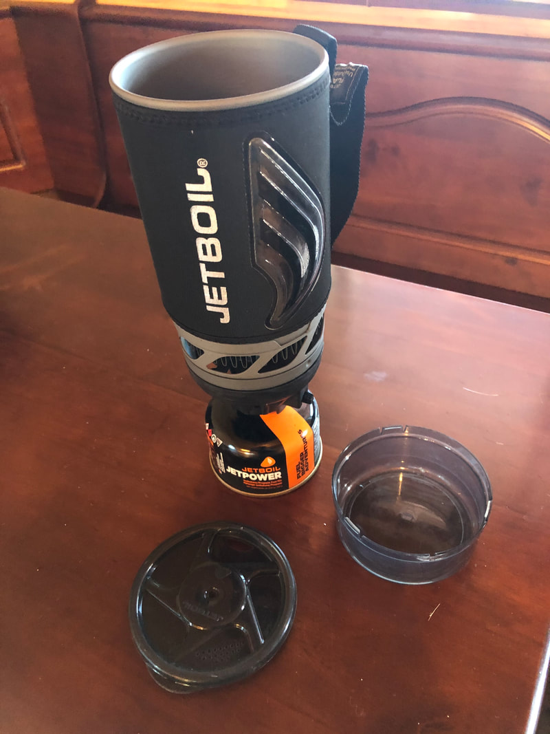
I made my first meal, and a thermos of Morrocan mint tea, using my new Jetboil.
Now I understand why my son, whose demonstration of the gadget sold me on the concept, pointedly mentioned that unlike my titanium spork, his titanium spork folds in half. There’s no great place to store my spork in the weird and in many cases decades-old collection of gear that supports my notion of moto-camping, but if my spork folded in half it could be stashed right inside the Jetboil’s attached multi-purpose cup.
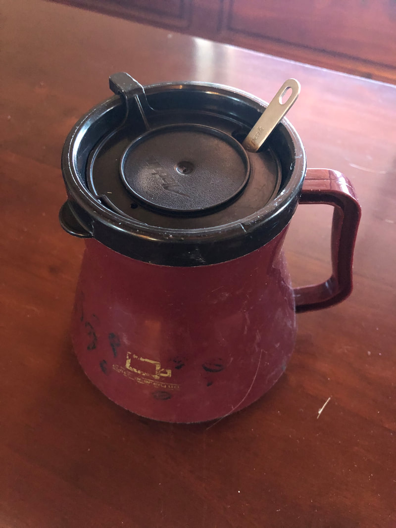
At least my spork does fit almost completely inside my favorite camping mug:
At least my spork does fit almost completely inside my favorite camping mug:
This mug is insulated and apparently indestructible, and has a large flat base that’s stable almost anywhere, and a lid with a thumb-controlled slide that shuts completely and thus keeps creepy crawlies out.
I had decent internet access right at my picnic table, so I pulled up my saved Google map and made up the day’s route sheets.
Only 2 pages.
But no time to publish a blog, I wanted to get moving on what was so far a mild, nearly cloudless day. I broke camp and headed out.
Unlike yesterday, this day was a winner out of the gate. The weather could not have been nicer, the roads were just what I wanted: twisty, well-paved, and mostly unoccupied. I made it most of the way through page one before missing a turn.
My route had me 3 times entering KY-70, riding along it for a ways, then turning off on some smaller 3- or 4-digit road (or succession of roads) that would intersect KY-70 farther west. I don’t know how I missed the final turnoff, and I blithely just kept rolling along having a great time. I'd dispensed with the notion of putting mileages on my route sheet, and didn't recall how far the next junction was.
But at some point the road straightened out and I realized I wouldn’t have ever planned to be where I was now. That turned out to be Fredonia, where the only gas station was out of everything but diesel. Since I was getting uncomfortably low on fuel I checked for the nearest station which was in Marion, even farther from my intended route.
After topping up I had lunch at yet another Mexican joint where I was the lone diner. I figured out a better route back to my intended plan, which I rejoined at Symsonia. The route from there might have been fun for a while, if there’d been less traffic. In Wickliffe I turned north onto legendary Highway 51 but wasn’t on it for long, crossing the Ohio River north of town, and soon afterward crossing the Mississippi at Cairo.
At this point there wouldn’t be a lot of great roads across the flat bottomlands, as is apparent considering that even my original route had me spending quite a few miles droning westward on I-57. My enjoyment of this leg was not improved by the gusting southerly crosswinds, and I spent much of the time riding sideways, canted heavily into the relative wind just to keep going straight.
I missed the turnoff to road N because it came up with no warning and I barely saw the sign from my position in the left lane; there was no safe way to get over in time. But it was of no consequence, I just took the next road north and soon hit the next crossroad I was looking for. I was now into the foothills of the Mark Twain National Forest, and finally the roads started having curves again.
Unfortunately there was a fair amount of traffic, which periodically harshed my mellow between segments on which I could enjoy myself better.
After gassing up I decided I was tired of the navigation chores, which I’d again begun to fumble. I was now close enough to my destination that there were mostly only curvy roads left to choose from, and I didn’t particularly care which of them I rode in on. So I punched up Google Maps on my phone, plugged in my earbuds, and headed north with my new soundtrack playing. Occasionally the music would mute and Google Gal would tell me to turn.
It was working really well. I no longer had to think about finding my way and the roads soon turned into just what I’d been looking for: twisties with nobody else on them.
The one time previously I’d ridden in Mark Twain Nation Forest it had rained all day, so I doubly enjoyed this balmy afternoon which had thoughtfully provided a high overcast in the west so I didn’t have to stare into the descending sun.
There was a problem when I got to Piedmont.
Google Gal was no longer giving me directions. Even if I was still on the right road, she should have been telling me to “continue straight” as I proceeded through intersections.
I pulled into a church parking lot and checked my phone.
No service.
This was unusual in my experience; I've been on Verizon for many years and have been remarkably few places without cell coverage, especially considering my tendency to travel to remote, unpopulated locales.
Sigh. Even before discovering Google navigation’s apparently non-overrideable algorithm favoring major roads, I’d wondered if the method would have a fatal flaw of failing completely when the cell signal was lost.
It does.
This is probably of no concern to people who only ever want to get from point A to point B as quickly and easily as possible via main roads where cell towers are invariably plentiful. But I deliberately go to places where there may be no good reason to place a cell tower at all.
The fact that I couldn’t even get a signal while right in town should have told me something.
But I’d seen a sign for the park on the way into town (and had been puzzled that Google Gal didn’t tell me to turn), so I retraced my path and hung a left, and a dozen or so miles later I was at Bluff View park on Clearwater Lake.
I pulled up to the entrance tollbooth, where no gate barred my further progress, and looked for after-hours campsite instructions.
A sign announced, “PARK CLOSED FOR SEASON”. But here’s the thing: immediately below those words, that very same sign advertised “FREE CAMPING”. A second sign which apparently related to in-season park use suggested various camping-related fees.
I wasn’t sure what to make of this but I continued into the park and drove around the campground loops, which were utterly deserted. Plenty of boats in the marina, but at this point very few moving on the lake. A couple people were down by the shore in a black pickup, but it didn’t look like they were camping.
I selected a campsite as far as possible from, and nearly out of sight of, what I assumed was the ranger’s house.
The water and electric at the site were shut off, and the rest room/showers were completely locked; even the drinking fountains were dry.
Aside from that there was nothing apparently stopping me from staying the night.
I pondered my options.
A possibility would be to go back to town and look for a hotel.
But I’d arrived just before dusk, and that would mean a ride through the woods at the worst possible time in terms of deer strike potential.
Staying at Bluff View risked the potential of being hassled by The Man, but as the sun set that seemed an increasingly unlikely possibility.
The biggest problem with staying at Bluff View was that I’d be unable to send out a text to my family letting them know I’d arrived safely.
But I’m notorious for ending up in places without connections, and they’d probably assume no news/good news.
One thing for sure, this idea of camping to minimize potential COVID exposure/spread was definitely working well.
I boiled water from my canteen and ate two Maruchan Instant Lunches – spicy noodles – not so much because I was hungry but because they were taking up space in my saddlebag and the schedule said they should both be gone by now; I hadn’t eaten the first night at Nolin Lake because I’d still felt full from The Old Gringo’s fajita.
It was quite windy and I debated whether to pitch my tent, but decided instead to sling my hammock from the steel pillars of the shelter, dangling above the picnic table. It was an iffy proposition; I wasn’t sure I’d be able to sleep comfortably all night in the hammock, and furthermore with the wind the way it was now any rain – which didn’t appear all that unlikely – would be horizontal and I’d get soaked.
But I took the chance and it worked out well.
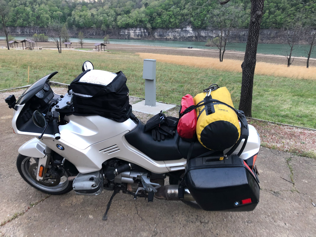
The full moon rose and I spent much of the night gazing at Nada 3, whose “pearl silver” paint has always looked magical under moonlight; she assumes a mystical glow in which I keep expecting runic inscriptions to someday be revealed.
Shoulda named this bike Shadowfax.


 RSS Feed